Summary
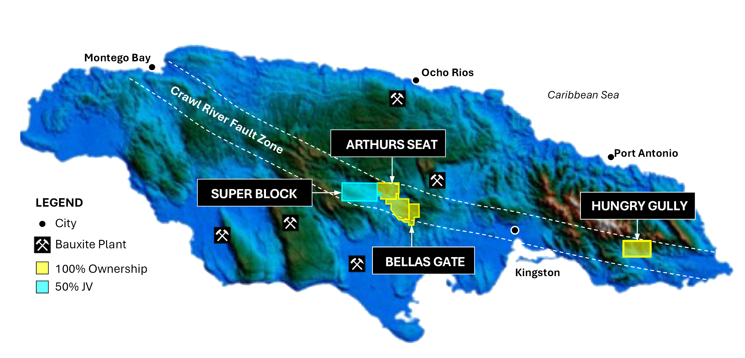
The Hungry Gully Project (HGP) consists of a wholly-owned Special Exclusive Prospecting Licenses (SEPL) covering 48 sq. km. The HGP is located within the southern part of the highly tectonized altered and mineralized Cretaceous Blue Mountain Inlier.
Geology
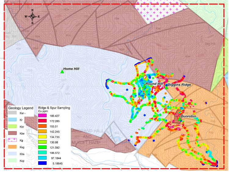
The geologic history of subduction, crustal thickening and tectonism has produced extensive mineralization within areas of Cretaceous rock throughout the Caribbean, such as at the Pueblo Viejo deposit, which contains more than 20 million ounces gold reserves (Barrick Gold Corp. website as at March 31, 2023). The HGP lies just north of a strong deep crustal fault and shear system that spans the entire island. Sheared and altered volcanic and sedimentary rocks are found adjacent to altered Cretaceous aged intrusives. Thermal gold system at Round Hill within the HGP that may be distal and to a copper + gold ± molybdenum system at the nearby Dunrobin site.
Potential
Exploration and prospecting to date, although limited, demonstrates the excellent potential at HGP for economically-viable epithermal gold and copper-gold skarn and porphyry deposit.
Recent Results
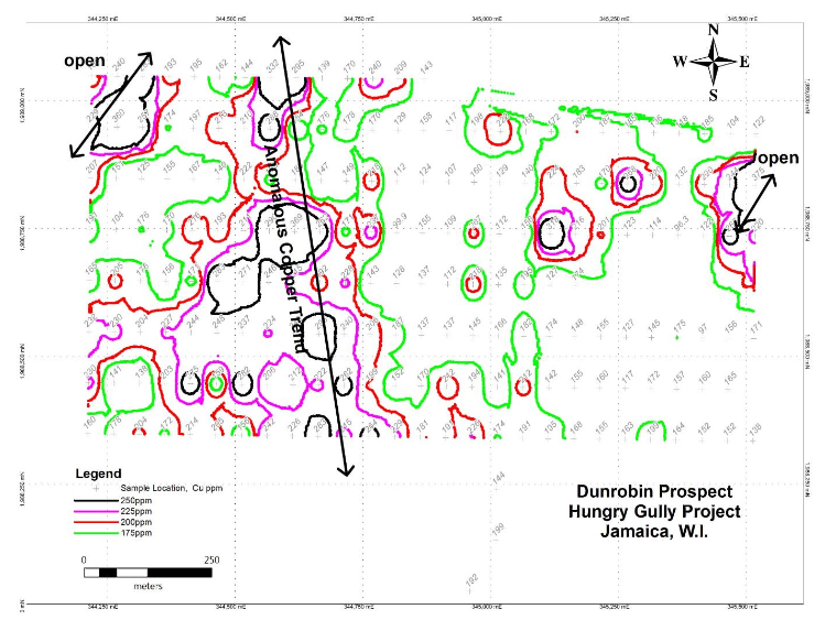
Soil sampling by C3 Metals has indicated a strong copper in soil anomaly at the Dunrobin Prospect. Several continuous 200ppm Cu contours indicate significant copper mineralization in nearby bedrock. All anomalies are open along strike with the central zone indicating at least 750m of strike length. No drilling has been done on the Dunrobin prospect.
Previous Exloration
Exploration by BHP in the 1990s indicated the presence of an epithermal gold system at Round Hill within the HGP that may be distal and to a copper + gold ± molybdenum system at the nearby Dunrobin site.