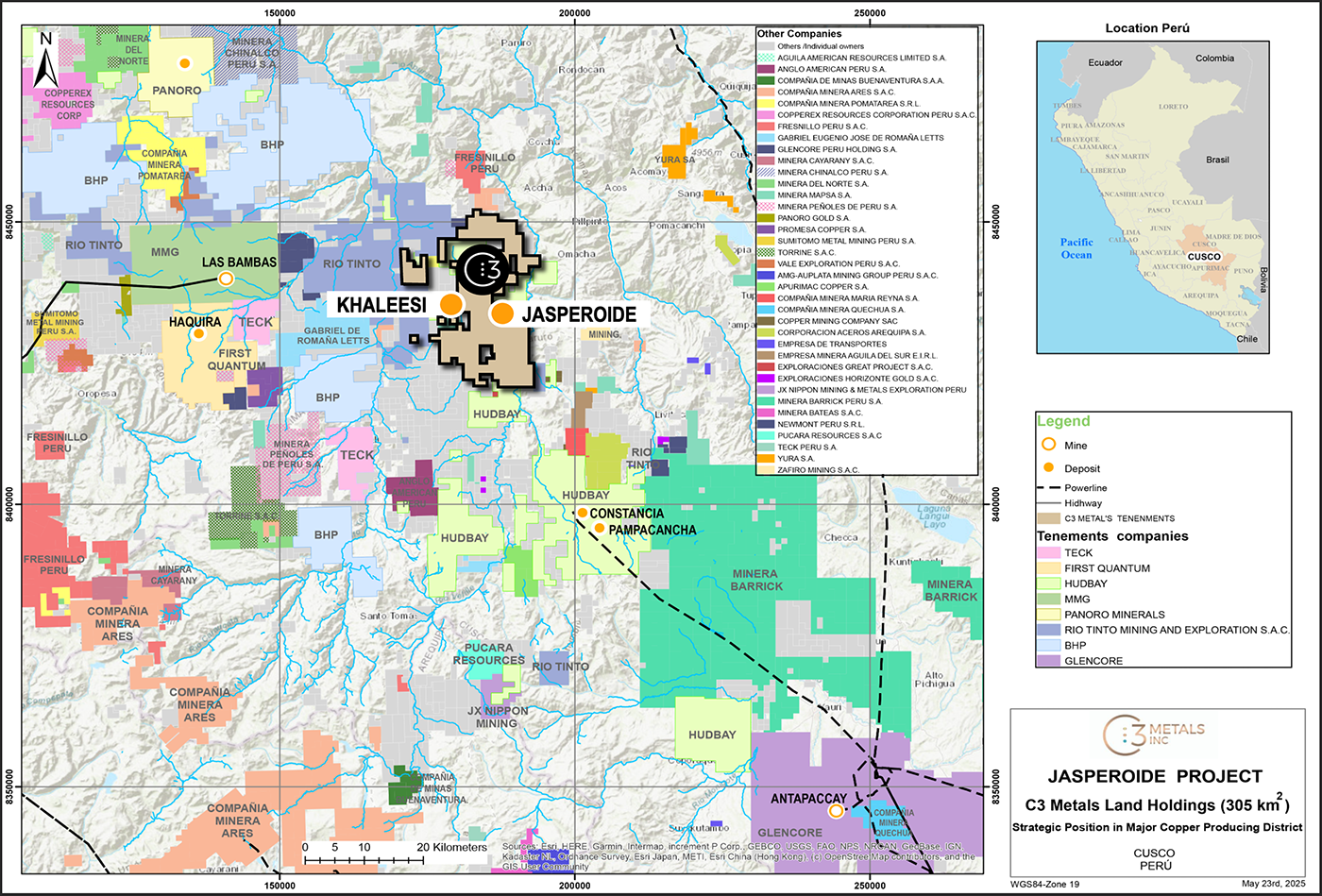
Khaleesi is an undrilled copper-gold skarn, epithermal and porphyry prospect in the Andahuaylas–Yauri belt of southern Peru, ~8 km west of C3 Metals’ Jasperoide project and within 45 km of the Las Bambas (MMG) and Constancia (Hudbay) operations. C3 Metals controls ~31,000 ha in the district.
Regional map showing C3 Metals' mineral concession package in relation to other large-scale operations, development projects and exploration projects.
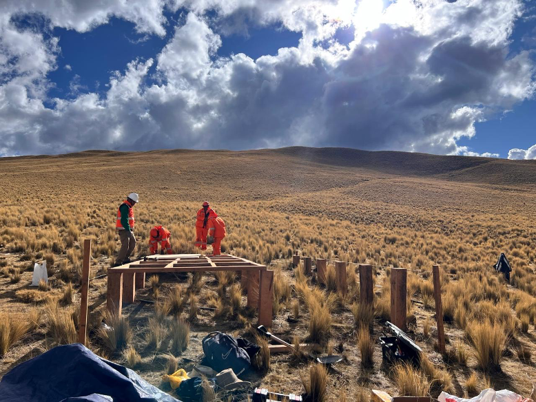
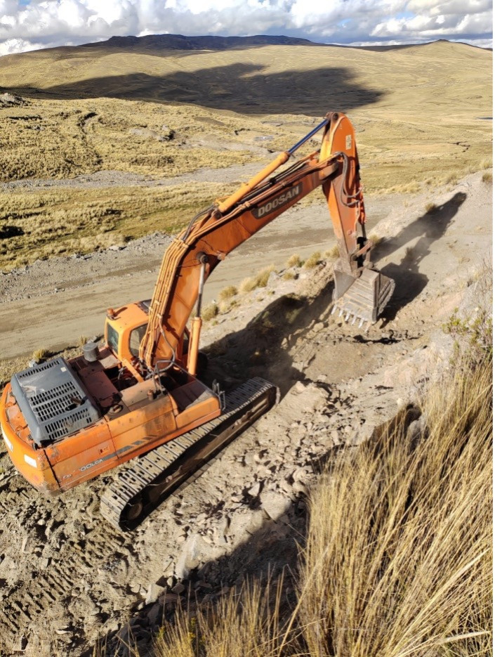
In 2025, C3 Metals completed grid soil geochemistry and ground geophysics (Mag, IP, MT), outlining large, coincident anomalies beneath a thin glacial till that masks parts of the target area. All regulatory approvals for a maiden drill program have been obtained, and a 14-hole, ~6,000 m program has commenced.
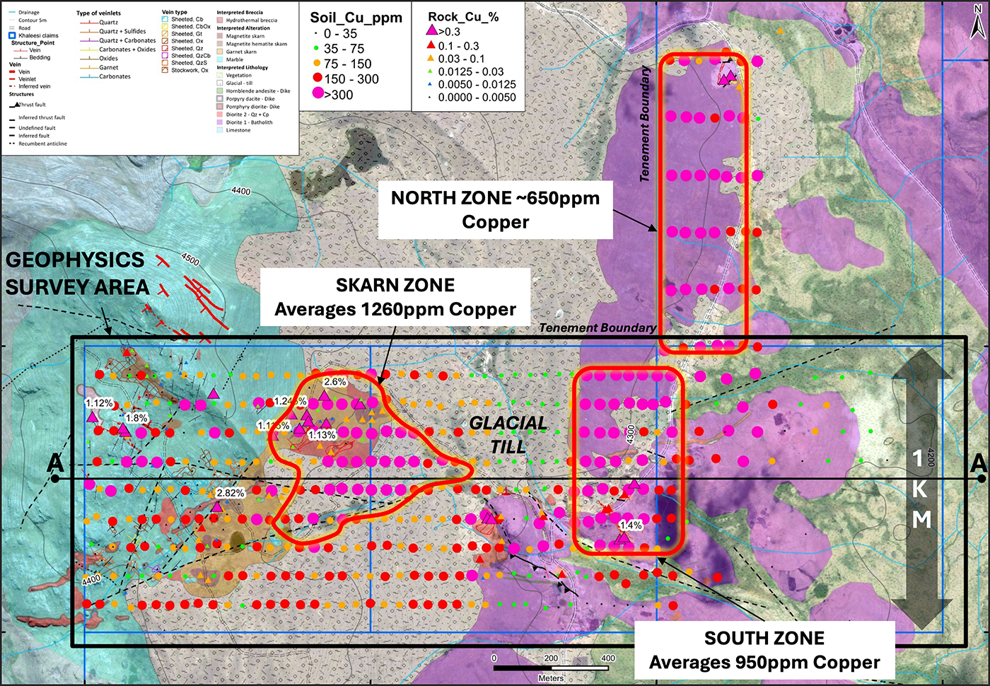
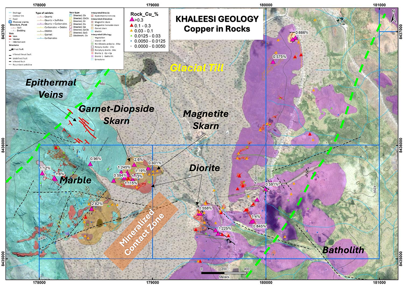
Khaleesi map showing three well defined zones of pervasive copper-in-soil geochemistry. Also showing glacial till zone that appears to conceal mineralized rock below.
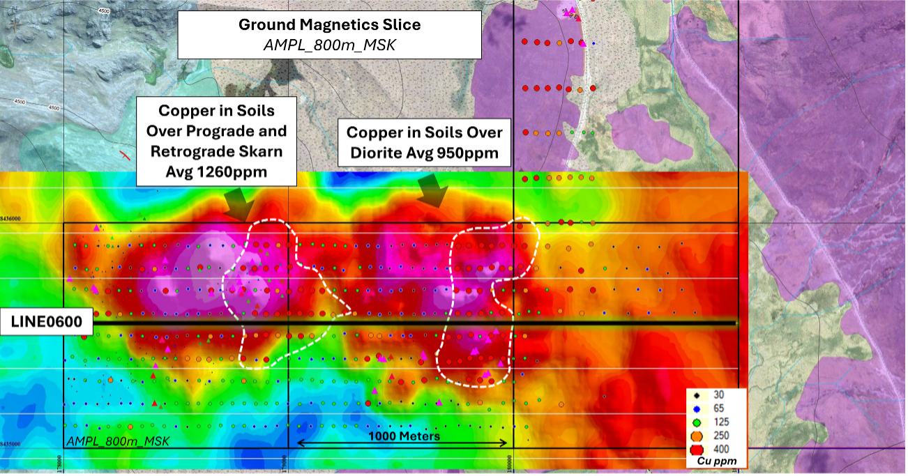
MVI Magnetic Inversion: Amplitude of Magnetization, depth slice 800m showing two large magnetic anomalies. The geophysical anomalies remain open along-strike to the east.
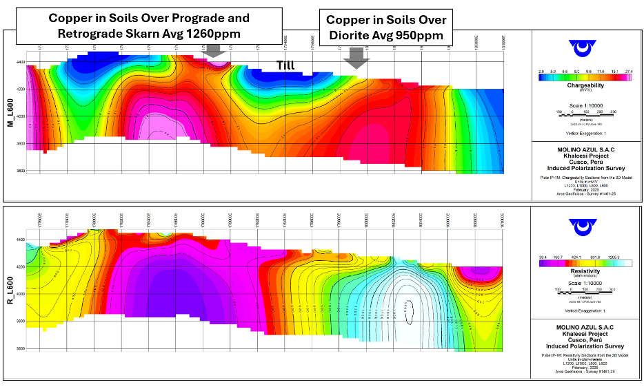
Vertical section chargeability (top) and resistivity (bottom) plot of 2025 IP survey line 600N looking to the north. The chargeability and resistivity anomalies have never been drill tested by C3 Metals or historically and correlate well with surface copper geochemistry.
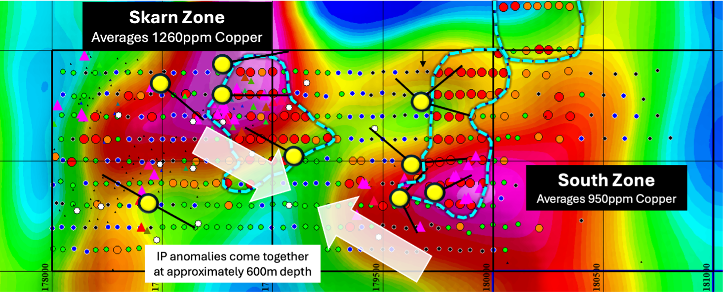
Plan view map of IP chargeability anomalies at 300m depth showing drill collar and hole locations for the initial Khaleesi 14-hole, 6,000m drill program. Note the locations of the strong copper in soil geochemical anomalies over the IP chargeability anomalies. The two IP chargeability anomalies come together at approximately 600m depth.
Geology
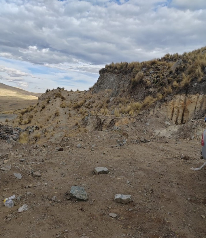
Khaleesi lies in the same porphyry–skarn corridor as Las Bambas and Constancia. Mapping confirms an extensive prograde and retrograde skarn system (~1,200 m × 1,000 m) with chalcopyrite-bornite mineralization, epithermal quartz-sulphide veins traced over ~2,000 m, and porphyry-style alteration in diorite dykes and stocks. A thin glacial till (generally <1–15 m) covers ~1.3 km² of the central area, likely concealing the connection between the skarn and porphyry centers indicated by geophysics.
Ground Mag, IP and MT define two near-surface chargeability bodies and a large conductive zone that correlate with copper-in-soil highs. The IP anomalies extend to ~600 m depth and appear to converge beneath the glacial cover—supporting a significant porphyry–skarn–epithermal hydrothermal system and guiding initial drill hole placement.
Mapping and Sampling
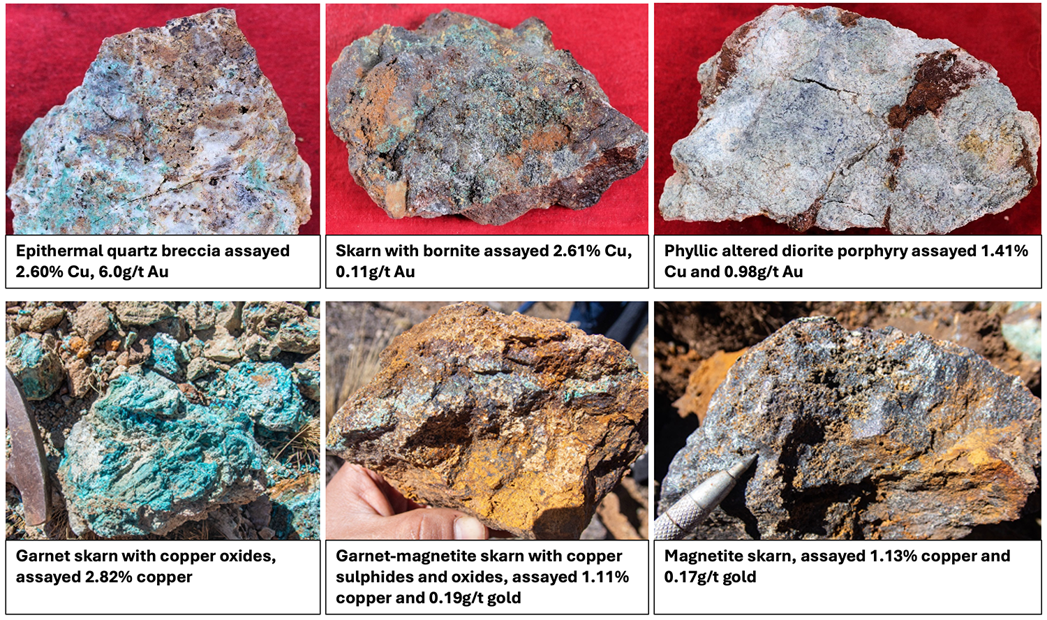
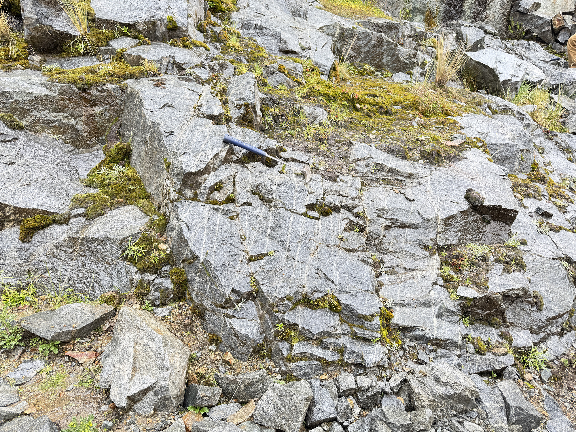
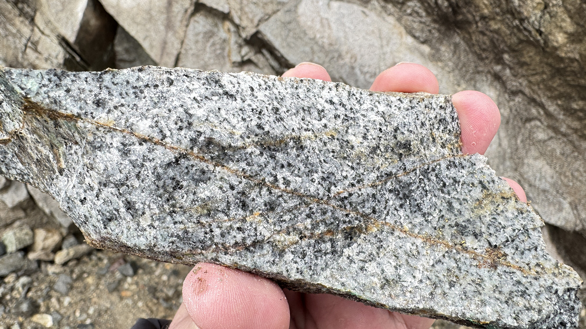
Mapping and sampling at Khaleesi have confirmed an extensive zone of prograde and retrograde skarn that measures 1,200 metres by 1,000 metres and remains open in multiple directions. Retrograde magnetite skarn is locally intensely mineralized with chalcopyrite and bornite sulphides. Epithermal quartz breccias and veins have been mapped along strike for over 2,000 metres and contain bornite, chalcopyrite and pyrite mineralization. These veins locally crosscut the skarn. Porphyry-style alteration and mineralization occurs in diorite dykes (up to 25-metres wide) and stocks in the eastern prospect area and along the batholith contact. The diorite and associated copper mineralization in the central prospect area are covered by glacial till varying in thickness from less than 1 metre to 15 metres. The diorite outcrops on both the western and eastern side of this glacial till. Geochemical and geophysical data collection will be important to understand the potential for a mineralized porphyry system beneath the glacial till, as there is outcropping porphyry-style mineralization and alteration on either side of the till occurrence.
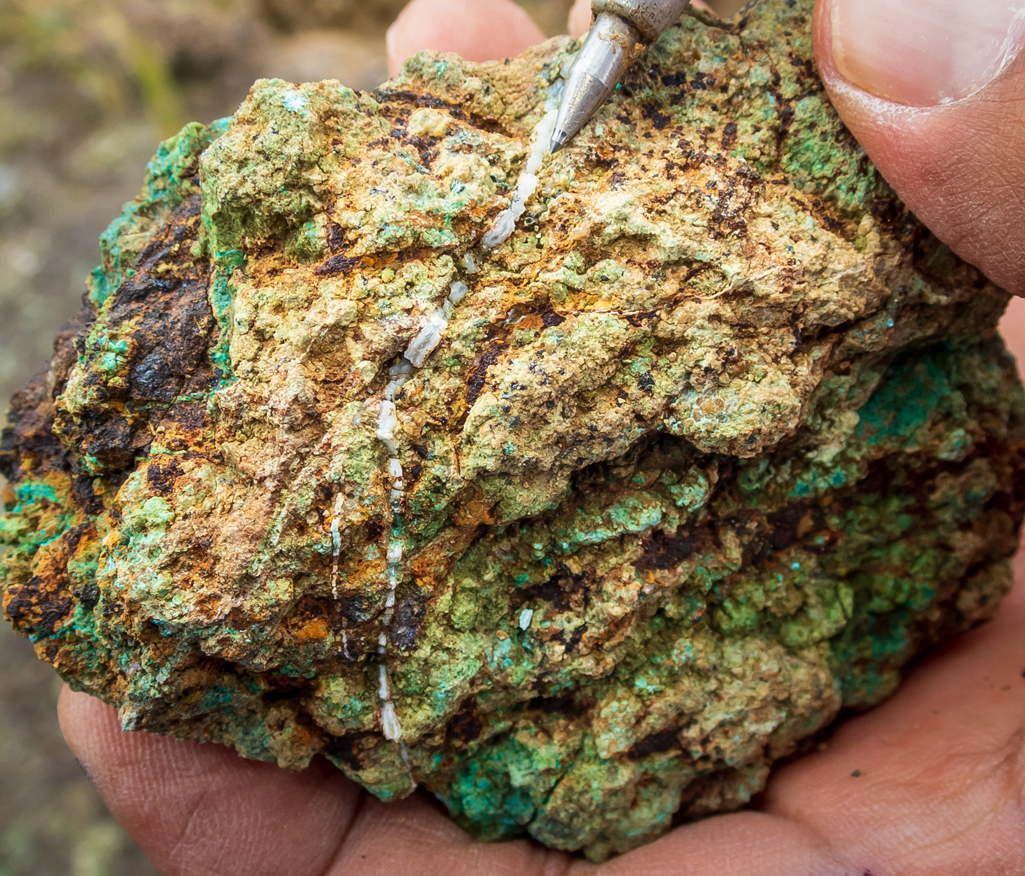
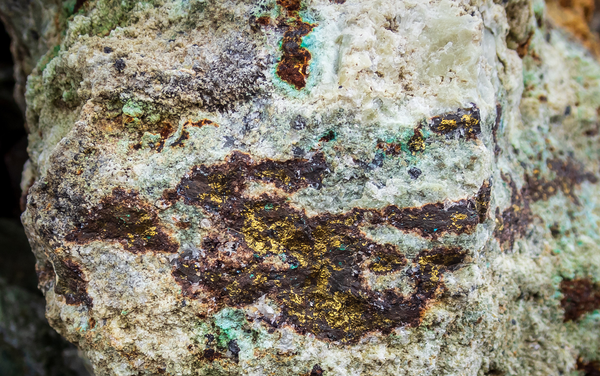
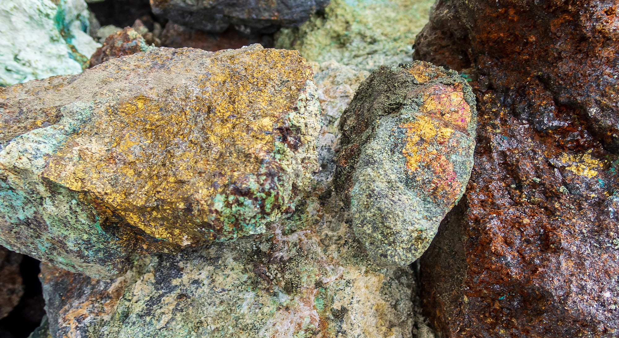
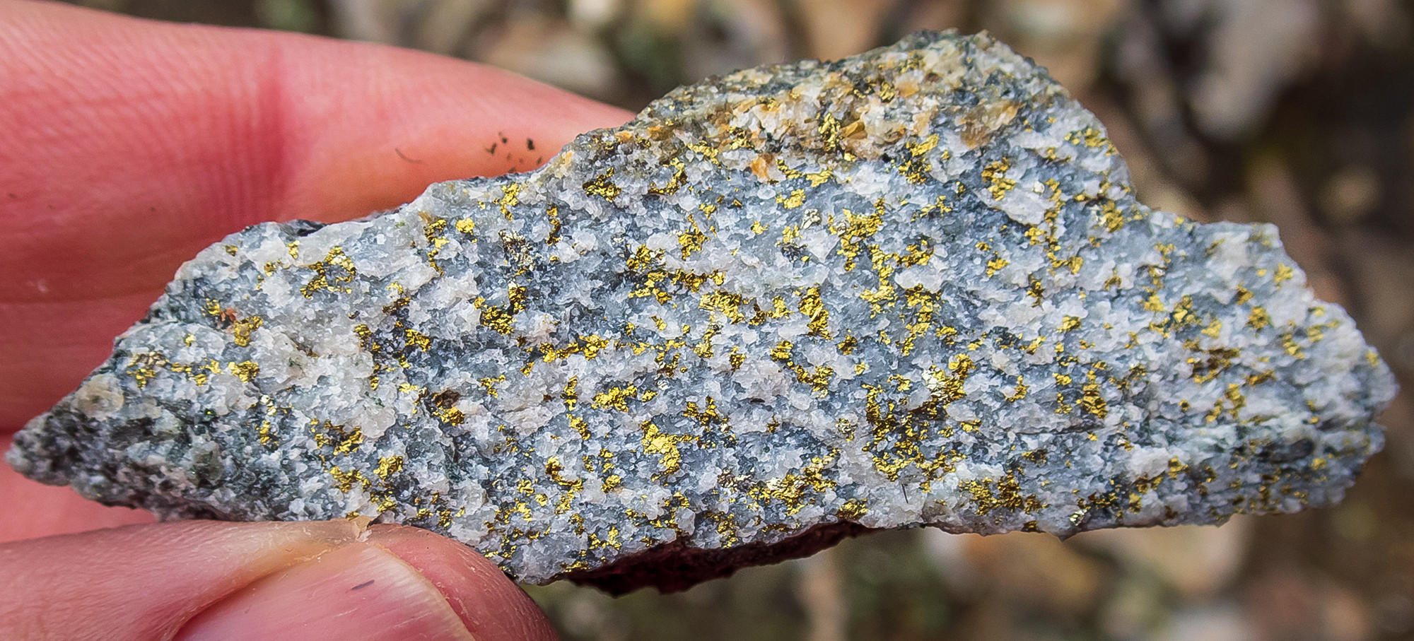
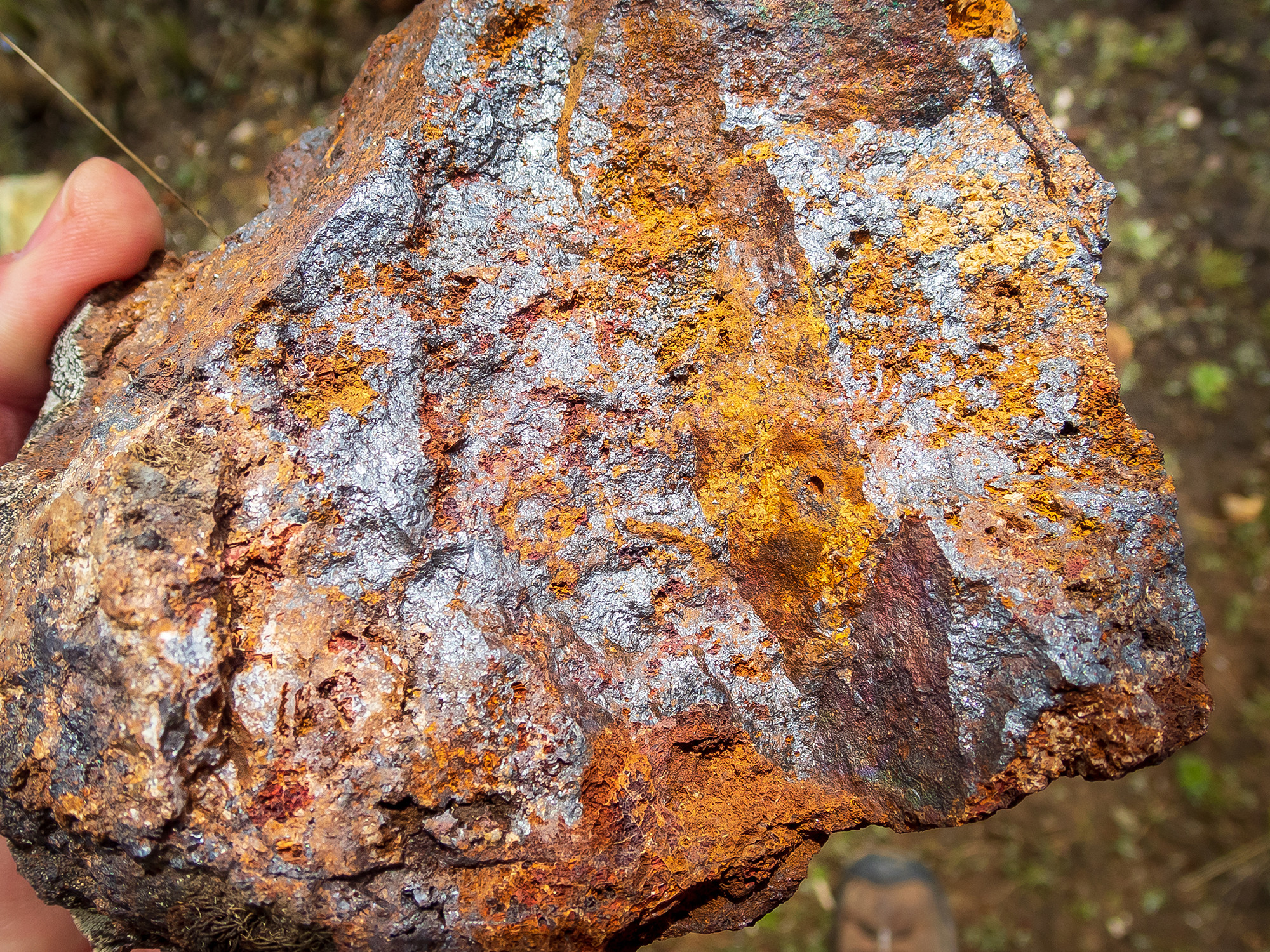
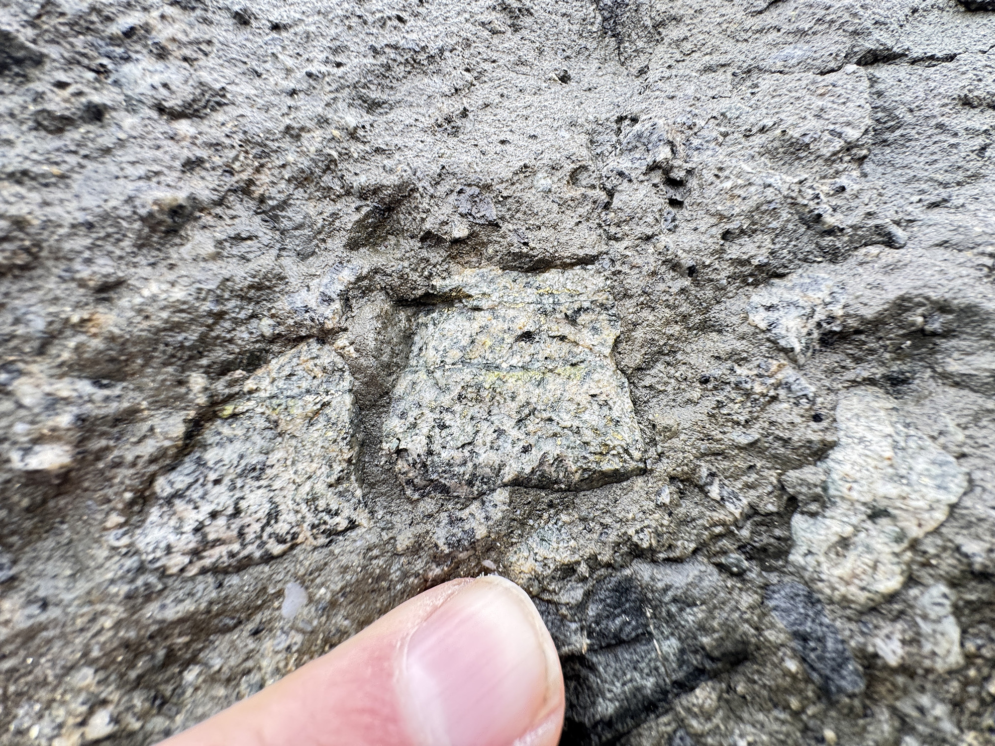
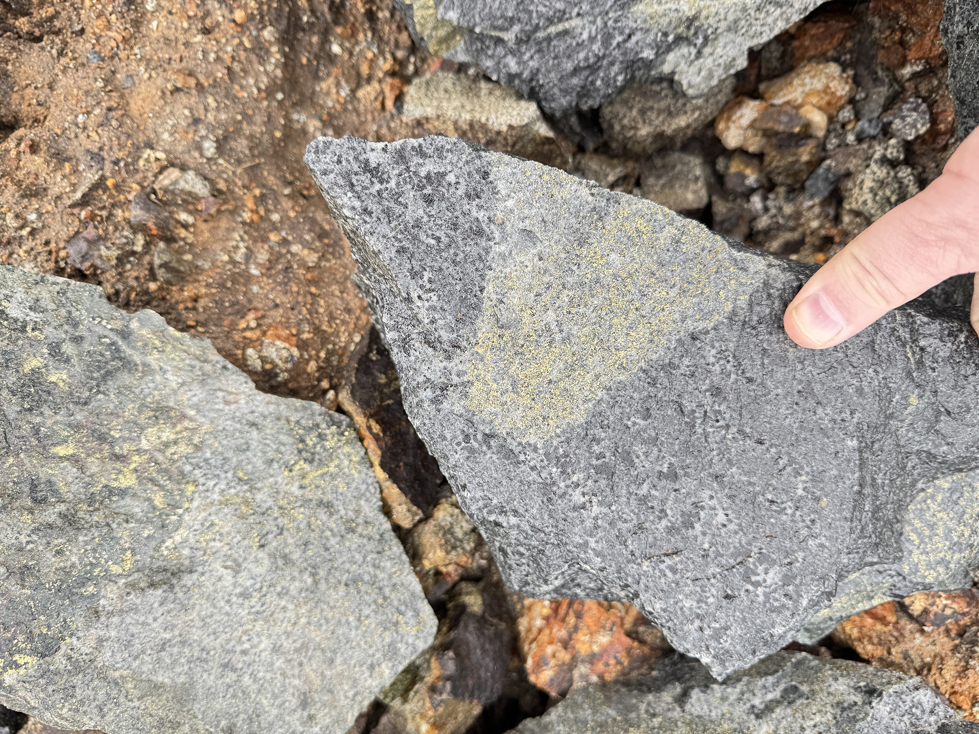
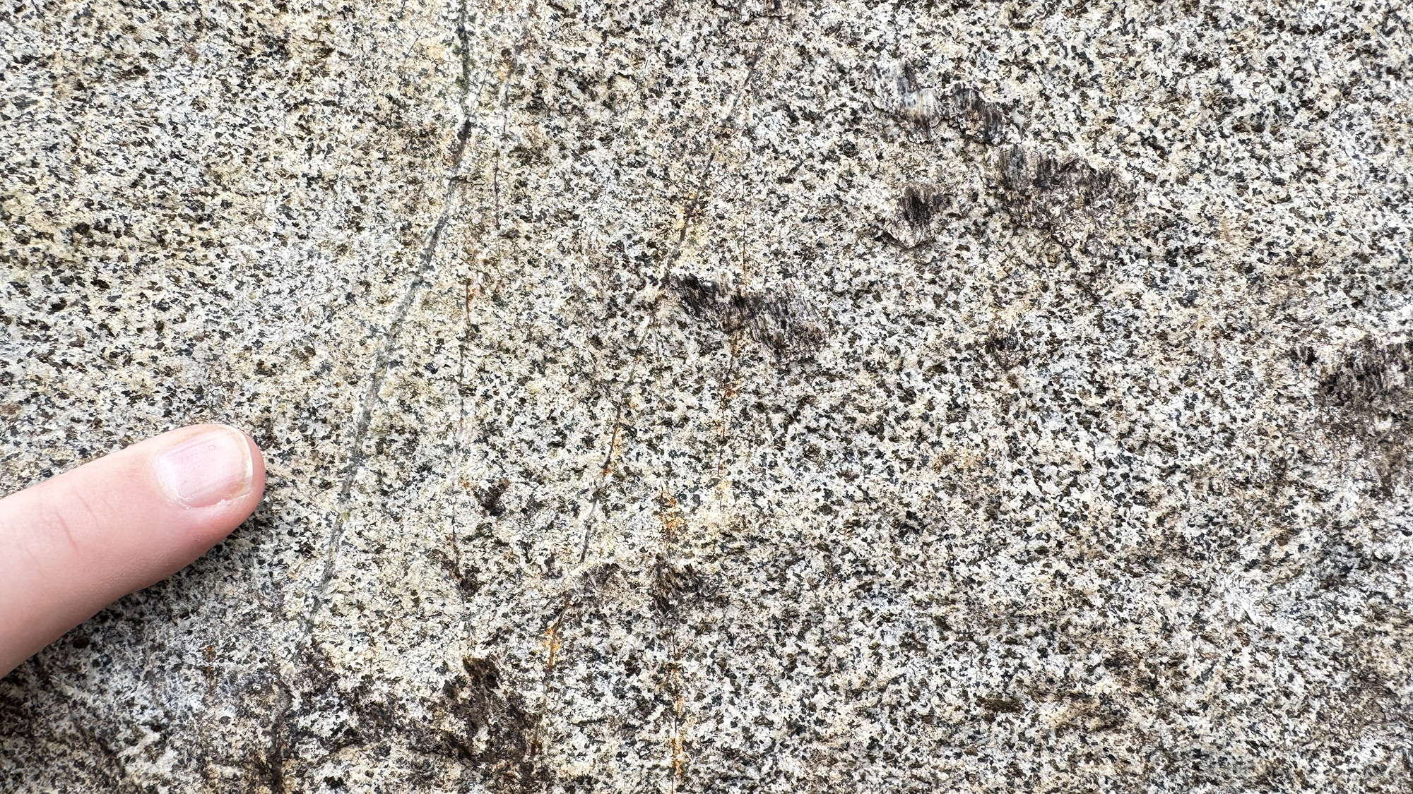
Rock Chip Gallery
Khaleesi > Rock Chip Gallery
Khaleesi rock chip sample - garnet skarnKhaleesi rock chip sample - garnet skarn, malachite & quartz veinsKhaleesi rock chip sample - calcite vein, chalcopyrite & malachiteKhaleesi rock chip sample - chalcopyrite, garnet skarn & malachiteKhaleesi rock chip sample - bornite, chalcopyrite & malachiteKhaleesi rock chip sample - chalcopyrite, diorite, muscovite & silica floodingKhaleesi rock chip sample - magnetite skarnKhaleesi rock chip sampleKhaleesi rock chip sampleKhaleesi rock chip sampleKhaleesi rock chip sampleKhaleesi rock chip sample
Project Highlights
Strategic location: 100% owned by C3 Metals Inc. ~8 km west of Jasperoide’s MCZ Resource of 51.9 Mt at 0.50% Cu and 0.20 g/t Au, M&I (Go to Mineral Resource Estimate)
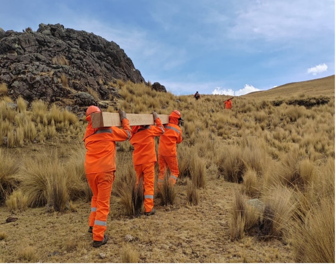
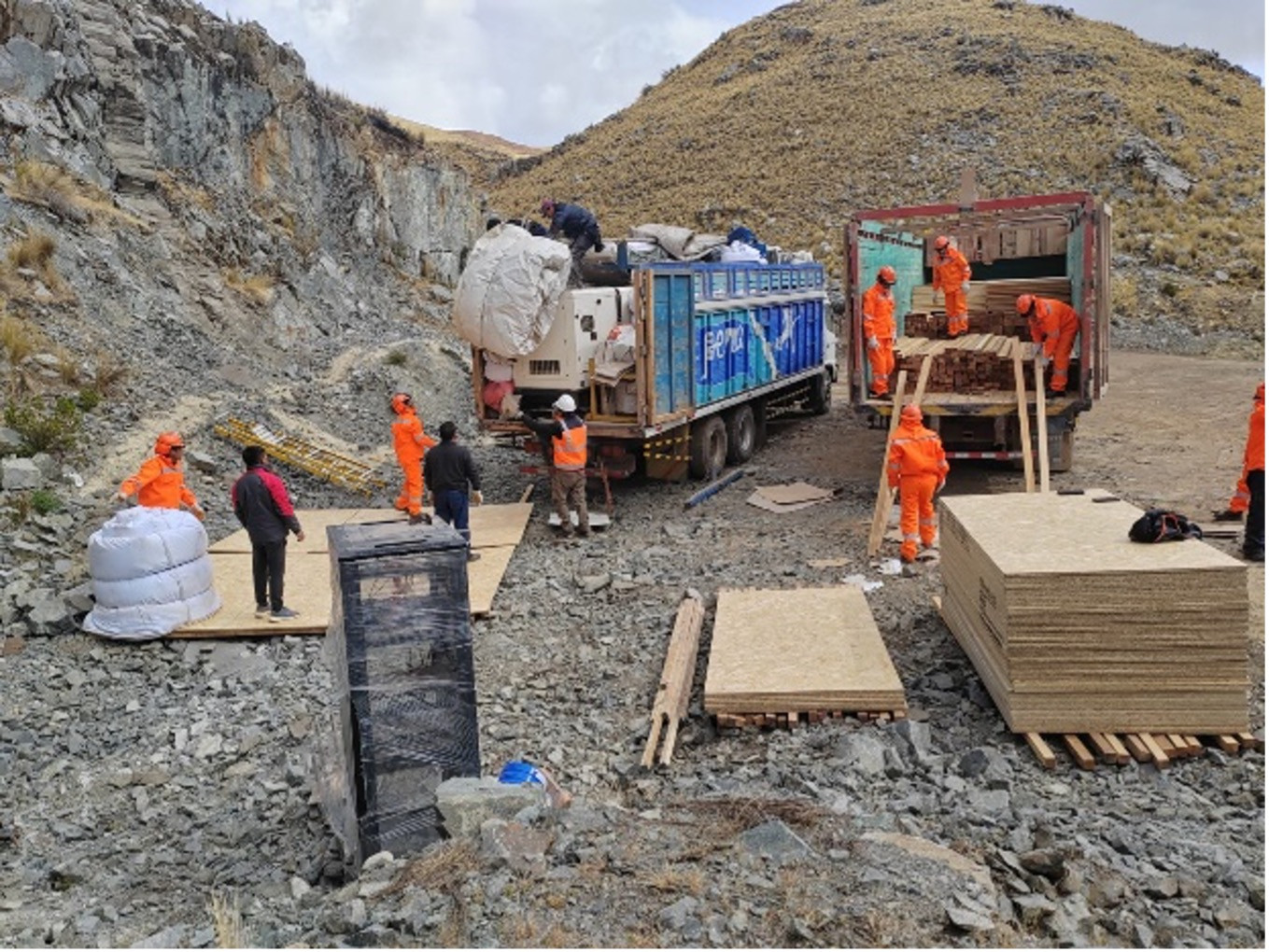
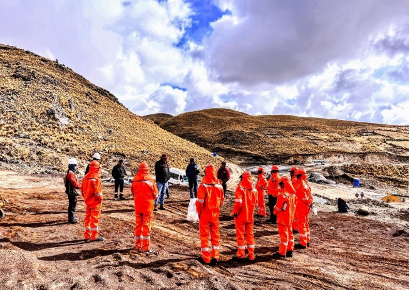
Advancing to first drilling: All approvals in hand; 14 holes (~6,000 m) planned, with access trails, pads and camp construction underway. (See PR August 27, 2025)
Tier-1 undrilled target scale: Coincident Mag, IP and MT anomalies align with high-tenor copper in soils; anomalies converge at depth beneath glacial cover. (See PR August 6, 2025)
Strong Geochemistry Footprint: Magnetic ("Mag"), Induced Polarization ("IP") and MagnetoTelluric ("MT") anomalies coincide with a recently defined high-grade copper-molybdenum in soil anomaly measuring 1,900m by up to 650m and a high-grade copper-zinc in soil anomaly measuring 470m by 400m averaging ~1,260 ppm Cu. (See PR February 19, 2025)
High-grade rock chips: Up to 2.82% Cu, 6.0 g/t Au, 57.7 g/t Ag and 403 ppm Mo from outcrop sampling across skarn, epithermal veins and diorite dykes. (See PR October 22, 2024)
Community agreement in place: Surface access rights agreement executed with the Cancahuani community (See Press Release August 13, 2024).
I agree to and consent to receive news, updates, and other communications by way of commercial electronic messages (including email) from C3 Metals Inc. I understand I may withdraw consent at any time by clicking the unsubscribe link contained in all emails from C3 Metals Inc.
C3 Metals Inc.
161 Bay Street,
27th Floor,
Toronto, ON
Canada, M5J 2S1 info@C3Metals.com